Friday, February 29, 2008

From Power Cruising, April 2008


“Many people have written books about chucking their stressful careers and moving aboard a boat. Most of these are amateurish travelogues that fail to inspire or touch the reader. Not so Mary South's THE CURE FOR ANYTHING IS SALT WATER (a quote from Isak Dinesen). This is an honest, open, wonderfully written story of personal discovery, in which the author embraces a relationship with boats and the sea, using her new perspective to reexamine relationships with friends and lovers, past and present.”

Thursday, February 28, 2008

Wave Runner

A new propulsion system for boats ditches the diesel

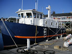
Going the Distance: Captain Ken-ichi Horie, aboard the Suntory Mermaid II, prepares to travel solo 4,350 miles from Hawaii to Japan on wave power alone. Photo by S. Yamada

This month, 69-year-old Japanese sailor Ken-ichi Horie will attempt to captain the world’s most advanced wave-powered boat 4,350 miles from Hawaii to Japan. If all goes as planned, he’ll set the first Guinness world record for the longest distance traveled by a wave-powered boat and, along the way, show off the greenest nautical propulsion system since the sail.

A simple spring system enables twin fins beneath the bow of the Suntory to move up and down with the incoming waves and pull the boat forward.
At the heart of the record-setting bid is the Suntory Mermaid II, a three-ton catamaran made of recycled aluminum alloy that turns wave energy into thrust. Two fins mounted side by side beneath the bow move up and down with the incoming waves and generate dolphin-like kicks that propel the boat forward. “Waves are a negative factor for a ship—they slow it down,” says Yutaka Terao, an engineering professor at Tokai University in Japan who designed the boat’s propulsion system. “But the Suntory can transform wave energy into propulsive power regardless of where the wave comes from.”

Horie’s latest adventure builds on a storied career of eco-sailing. In 1993 he pedaled a boat 4,660 miles, from Hawaii to Okinawa, setting a world record for the longest distance traveled by a pedal-powered boat.

In 1996 he set the world record for the fastest crossing of the Pacific Ocean in a solar-powered boat. And in 1999, he made a solo trip across the Pacific in a catamaran made from recycled beer barrels.
With a maximum speed of five knots, the Suntory will take two to three months to complete a voyage that diesel-powered craft accomplish in just one. But speed is not the point. The voyage aims to prove that wave propulsion can work under real-world conditions, opening up the technology for commercial applications such as cargo shipping. “Oil is a limited power source,” Horie says, “but there is no limit to waves.”

How to Ride Waves Across the Pacific

Electricity A set of eight solar panels produces 560 watts to run the navigation lights, ham radio, satellite phone and PC.

Propulsion Dual fins set in a side-by-side configuration beneath the bow convert wave energy into a dolphin-like kick that can propel the three-ton boat at five knots.

Stability The fins absorb energy from the rocking of the boat to help make the propulsion more efficient.

Hull The outer hull, only three millimeters thick, is made of a durable recycled-aluminum alloy.

Outboard Motor Reserved for extreme emergencies.

http://www.popsci.com/gear-gadgets/article/2008-02/wave-runner

Thursday, February 21, 2008

Ferry sinks in Amazon collision

From the BBC
BBC map
At least three people have been killed and 20 are reported missing after a ferry sank as a result of a collision with a barge on the Brazilian Amazon.

They collided during the night near Itacoatiara in the jungle state of Amazonas, and most victims seem to have been trapped in cabins on the ferry.

More than 100 people were aboard the ferry at the time, local sources say.

A rescue official said the chances of finding any of the 20 people missing alive were remote.

A navy vessel and a helicopter are being used to help in the search operation.

Lunar eclipse

State fire spokesman Lt Clovis Araujo said a nearby floating police station and a number of small boats had rescued 92 people from the ferry, the Almirante Monteiro.

There were no reports of damage or casualties aboard the heavy goods barge, he was quoted as saying by the Associated Press news agency.

The confirmed dead, he added, were a woman and two children.

State public safety department spokesman Aguinaldo Rodrigues said that nearly all the survivors appeared to be passengers sleeping in hammocks on the ferry's deck.

While it was too early to establish the cause of the collision, he added, visibility had been "very poor" during the lunar eclipse which began on Wednesday night.

The collision happened on an isolated stretch of the river.

The ferry had a capacity of 165 passengers but was not full at the time of the accident.

An inquiry will now be launched to try to establish the cause of the collision and an initial report is expected within 90 days.

Tuesday, February 12, 2008

U.S. Can Claim More Arctic Territory

Study: U.S. Territory Extends Farther Into Oil-Rich Region

Image showing the top of the world and the area mapped by NOAA and the University of New Hampshire
This map shows the Arctic region, with a highlighted area north of Alaska that was surveyed by NOAA and University of New Hampshire researchers during expeditions in 2003, 2004 and 2007.
Photo: UNH/NOAA
By Dan Shapley

After three years of expeditions to the Arctic, the National Oceanographic and Atmospheric Administration and the University of New Hampshire have made a discovery that is convenient for U.S. interests in an oil-starved world over-heated up by global warming.

The continental slope of Alaska, they say, extends 100 nautical miles farther under the Arctic Sea than previously thought. That means the U.S. can claim greater territory north of Alaska, should it ever get around to signing the U.N. Convention on the Law of the Sea. That 25-year-old international treaty allows signatories to claim territory based in part on the extent of the continental shelf.

“We found evidence that the foot of the slope was much farther out than we thought,” said Larry Mayer, expedition chief scientist and co-director of the Joint Hydrographic Center at UNH. “That was the big discovery.”

Russia, in its Arctic expeditions last year, during which seamen planted a titanium flag on the sea floor at the North Pole, claimed that its territorial claims were supported by new maps of the continental shelf. Three other countries also can claim territory in the Arctic.

The territory matters now more than ever, as the world's oil supply declines and global warming continues to melt the Arctic. Significant oil reserves are believed to be locked beneath the ice, but as the climate warms, they could become accessible. Last summer, Arctic sea ice retreated to the greatest extent ever recorded.

Coastal nations have sovereign rights over the natural resources of their continental shelf, generally recognized to extend 200 nautical miles out from the coast. The Law of the Sea Convention, now under consideration in the U.S. Senate, provides nations an internationally recognized basis to extend their sea floor resource rights beyond the foot of the continental slope if they meet certain geological criteria backed up by scientific data.

“We now have a better geologic picture of what’s happening in that area of the Arctic,” said NOAA Office of Coast Survey researcher Andy Armstrong, co-chief scientist on the expedition and NOAA co-director of the Joint Hydrographic Center. “These are valuable data for NOAA and the United States, and I’m pleased that we’re making them available for anyone to use.”

arctic sea floor topography

UNH/ NOAA

Above: A view of the Arctic sea floor.

the Chukchi Borderland

UNH/ NOAA

Above: The Chukchi Borderland, a region of the Arctic sea floor north of Alaska.


© blogger templates 3 column | Tech Blog